Colorado Pass Road Conditions (webcams via CDOT)

Click on a highway icon below to see live road conditions
<
CDOT
                                                                            Interstate 70 Webcams CDOT Interstate 70 Webcams Interstate 25 North Interstate 25 North CDOT Interstate 76 Webcams CDOT Interstate 225 Webcams Denver Road Conditions NP Park Cams
West
Mountains
Denver to Utah
East
Eastern Plains
Denver to Kansas
 North
Denver to Wyoming
Ft Collins
South
Denver to
New Mexico
Colorardo Springs
East
Denver to Nebraska
Sterling
 Denver Metro
Aurora
Denver
City Streets
I-270
National Parks

<
U.S. 6 U.S. 24 U.S. 34 U.S. 36 U.S. 40 U.S. 50 U.S. 85 U.S. 160 U.S. 285 U.S. 287 U.S. 385 U.S. 550
Loveland Pass

Colorado Springs
Woodland Park
Buena Vista
Grand Lake
Loveland
Greeley
Boulder
Broomfield
Westminster
Berthoud Pass
Steamboat Springs
Winter Park
Pueblo
Montrose
Gunnison
Greeley
Fort Lupton
Brighton

Alamosa
Durango
Walsenburg
Conifer
Fairplay
Buena Vista
Longmont
Lafayette
Longmont
Ft. Collins
Holyoke
Wray
Burlington
Durango
Ouray
CDOT
                                                                            Vail Pass Road Conditions CDOT Berthoud Pass Road Conditions Loveland Pass Road Conditions Rabbit Ears Pass Road Conditions Monarch Pass Road Conditions Wolf Creek Pass Road Conditions Red Mountain Pass Road Conditions Colorado Pass Road Conditions
Vail Pass
I-70
Berthoud Pass
US 40
Loveland Pass
US 6
Rabbit Ears Pass
US 40
 Monarch Pass
US 50
 Wolf Creek Pass
US 160
Red Mountain Pass
US 550
More
Mountain
Passes

Colorado Mountain Passes – Live Road Cameras

Jump to a pass. Tap any camera to enlarge.

CO 14

Cameron Pass

CO 14

CO 14 through Poudre Canyon between Fort Collins and Walden · 10,276 ft

West Side – 1.2 mi W of the Summit (MP 64)

CO 14, 1.2 mi W of Cameron Pass – Looking East (toward the pass) CAMERA OFFLINE Old image – NOT current conditions
CO 14, 1.2 mi W of Cameron Pass – Looking East (toward the pass)
CO 14, 1.2 mi W of Cameron Pass – Looking West CAMERA OFFLINE Old image – NOT current conditions
CO 14, 1.2 mi W of Cameron Pass – Looking West
CO 91

Fremont Pass

CO 91

CO 91 between Copper Mountain and Leadville · 11,318 ft

Summit – CO 91 at Fremont Pass (MP 11.10)

CO 91 MP 11.10 at Fremont Pass – Looking North CAMERA OFFLINE Old image – NOT current conditions
CO 91 MP 11.10 at Fremont Pass – Looking North
CO 91 MP 11.10 at Fremont Pass – Looking South CAMERA OFFLINE Old image – NOT current conditions
CO 91 MP 11.10 at Fremont Pass – Looking South
CO 91 MP 11.10 at Fremont Pass – Road Surface CAMERA OFFLINE Old image – NOT current conditions
CO 91 MP 11.10 at Fremont Pass – Road Surface

North Base – Copper Mountain (MP 22.20)

● LIVE
CO 91 MP 22.20 at Copper Rd in Copper Mountain (Live Stream)
CO 9

Hoosier Pass

CO 9

CO 9 between Breckenridge and Alma · 11,542 ft

North Side – Breckenridge at Broken Lance Dr (MP 86.15)

● LIVE
CO 9 MP 86.15 at Broken Lance Dr in Breckenridge (Live Stream)

South Side – 1.8 mi N of Alma (MP 72.75)

CO 9 MP 72.75 N of Alma – Looking North (toward the pass) CAMERA OFFLINE Old image – NOT current conditions
CO 9 MP 72.75 N of Alma – Looking North (toward the pass)
CO 9 MP 72.75 N of Alma – Looking South CAMERA OFFLINE Old image – NOT current conditions
CO 9 MP 72.75 N of Alma – Looking South
US 285

Kenosha Pass

US 285

US 285 from Conifer over Kenosha Pass to Fairplay, east to west · 10,001 ft

East – Shaffers Crossing at CR 83 (MP 231.00)

US 285 MP 231.00 at Shaffers Crossing – Looking South (toward the pass) CAMERA OFFLINE Old image – NOT current conditions
US 285 MP 231.00 at Shaffers Crossing – Looking South (toward the pass)
US 285 MP 231.00 at Shaffers Crossing – Looking North CAMERA OFFLINE Old image – NOT current conditions
US 285 MP 231.00 at Shaffers Crossing – Looking North

East Side – Grant, 0.2 mi N of CR 60 (MP 207.85)

US 285 MP 207.85 in Grant – Looking South (toward the pass) CAMERA OFFLINE Old image – NOT current conditions
US 285 MP 207.85 in Grant – Looking South (toward the pass)
US 285 MP 207.85 in Grant – Looking North CAMERA OFFLINE Old image – NOT current conditions
US 285 MP 207.85 in Grant – Looking North

West Side – Jefferson, 0.7 mi N of CR 34 (MP 195.65)

US 285 MP 195.65 near Jefferson – Looking East (toward the pass) CAMERA OFFLINE Old image – NOT current conditions
US 285 MP 195.65 near Jefferson – Looking East (toward the pass)
US 285 MP 195.65 near Jefferson – Looking West CAMERA OFFLINE Old image – NOT current conditions
US 285 MP 195.65 near Jefferson – Looking West
US 285 MP 195.65 near Jefferson – Road Surface CAMERA OFFLINE Old image – NOT current conditions
US 285 MP 195.65 near Jefferson – Road Surface

West Side – Como at CR 15 (MP 192.55)

US 285 MP 192.55 at Como – Looking North CAMERA OFFLINE Old image – NOT current conditions
US 285 MP 192.55 at Como – Looking North
US 285 MP 192.55 at Como – Looking South CAMERA OFFLINE Old image – NOT current conditions
US 285 MP 192.55 at Como – Looking South

West – Fairplay at CO 9 (MP 183.00)

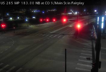
US 285 MP 183.00 at CO 9 in Fairplay – Looking North CAMERA OFFLINE Old image – NOT current conditions
US 285 MP 183.00 at CO 9 in Fairplay – Looking North
US 285 MP 183.00 at CO 9 in Fairplay – Looking South CAMERA OFFLINE Old image – NOT current conditions
US 285 MP 183.00 at CO 9 in Fairplay – Looking South
CO 145

Lizard Head Pass

CO 145

CO 145 between Telluride and Rico · 10,222 ft

North Side – Telluride, 0.8 mi S of Society Dr (MP 70.55)

CO 145 MP 70.55 near Telluride – Looking South (toward the pass) CAMERA OFFLINE Old image – NOT current conditions
CO 145 MP 70.55 near Telluride – Looking South (toward the pass)
CO 145 MP 70.55 near Telluride – Looking North CAMERA OFFLINE Old image – NOT current conditions
CO 145 MP 70.55 near Telluride – Looking North
CO 145 MP 70.55 near Telluride – Road Surface CAMERA OFFLINE Old image – NOT current conditions
CO 145 MP 70.55 near Telluride – Road Surface

South Side – Rico at Soda St (MP 47.25)

CO 145 MP 47.25 in Rico – Looking North (toward the pass) CAMERA OFFLINE Old image – NOT current conditions
CO 145 MP 47.25 in Rico – Looking North (toward the pass)
CO 145 MP 47.25 in Rico – Looking South CAMERA OFFLINE Old image – NOT current conditions
CO 145 MP 47.25 in Rico – Looking South
US 550

Molas Pass

US 550

US 550 between Durango and Silverton · 10,910 ft

South Side – 0.6 mi S of Purgatory Blvd (MP 48.60)

US 550 MP 48.60 near Purgatory – Looking North (toward the pass) CAMERA OFFLINE Old image – NOT current conditions
US 550 MP 48.60 near Purgatory – Looking North (toward the pass)
US 550 MP 48.60 near Purgatory – Looking South CAMERA OFFLINE Old image – NOT current conditions
US 550 MP 48.60 near Purgatory – Looking South
US 550 MP 48.60 near Purgatory – Road Surface CAMERA OFFLINE Old image – NOT current conditions
US 550 MP 48.60 near Purgatory – Road Surface

North Side – Silverton, 0.2 mi W of CO 110 (MP 70.65)

US 550 MP 70.65 in Silverton – Looking South (toward the pass) CAMERA OFFLINE Old image – NOT current conditions
US 550 MP 70.65 in Silverton – Looking South (toward the pass)
US 550 MP 70.65 in Silverton – Looking North CAMERA OFFLINE Old image – NOT current conditions
US 550 MP 70.65 in Silverton – Looking North
US 550 MP 70.65 in Silverton – Road Surface CAMERA OFFLINE Old image – NOT current conditions
US 550 MP 70.65 in Silverton – Road Surface
✕

Colorado Pass Road Conditions (webcams via CDOT)